Between May 7, 2001 and May 18, 2001 twelve of us canoed the Green River from Green River, Utah to the confluence of the Green River and the Colorado River in Canyonlands National Park.
Over the twelve days on the water we paddled 120 miles. We were: Bert and Sue Port, Dave and Linda Kennedy, Fred Thiessen, Emilee Fanjoy, Ken Holmes, Graham Kenyon, Peter and Nancy Macek, Ian Macek and Alan Macek.
All photos by Peter Macek unless otherwise noted.
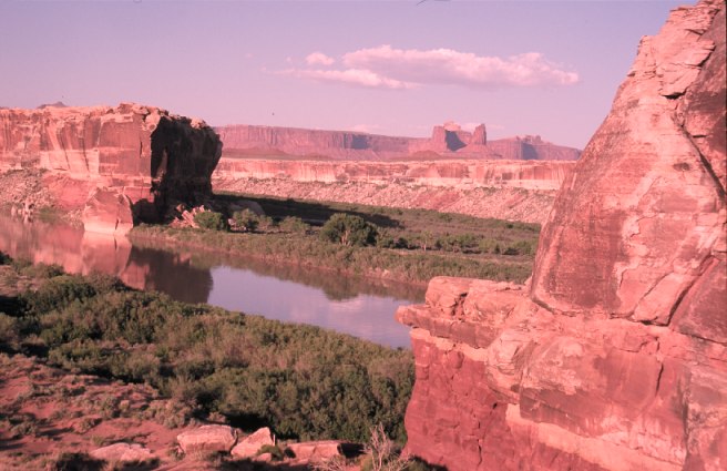
The sandstone cliffs of the canyon had an amazing red colour which caused great contrast with the vibrant green of the cottonwood trees. The photo to the right was taken in the early evening at “Anderson Bottom”. ‘Bottoms’ are the name given to the flat areas beside the river on the inside of the meanders. This one is named for the family that had a large farm at this location in the early 1900s. This place was important for us because we could get water from a fresh water spring. Because the desert was so dry we had to carry all our water in the canoes for the first 5 days of the trip (5 litres per day per person = 120L for my family)
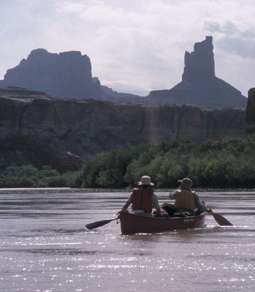
The photo to the left is of Ian and me. The canyon of the Green River has distinctive layering. The rock forming the buttes seen in the photo is Navajo Sandstone and rock rising out of the water is Wingate Sandstone. The river had very few ripples or rocks but flowed quite quickly. This meant that we did not have to do much paddling to make good distance.
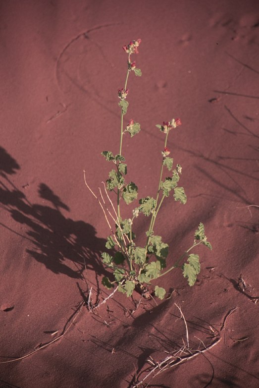
To the right is a picture of a Desert Globe Mallow surviving on a sand dune. A lot of the desert plants were in flower while we were in Utah. Some of the most spectacular were the vibrant reds and yellows of the cacti.
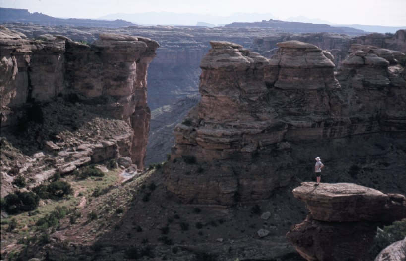
Near the end of our trip we stayed two nights at the same spot and went on a long day hike up to the canyon rim which was about 1500 ft higher than the Green River. Our hike started up a steep climb to the first pouroff of Water Canyon. The photo above is the view down Water Canyon over the pouroff. The Green River is just out of sight down the canyon. From this point we climbed over into Shot Canyon. Ian Macek is posing on the rock.
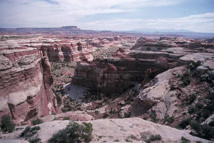
The photo to the right was taken after we had just hiked up Shot Canyon which is the one in the foreground. The Green River is several miles down this canyon. This area of the National Park is called the ‘Maze District’ for the obvious reason that it is almost impossible to get anywhere because of the deep canyons everywhere. The big mountains in the distant are the La Sal Mountains on the far side of Moab, Utah. Just behind the photographer is Chimney Rock which is accessible by four-wheel drive road from Hanksville.
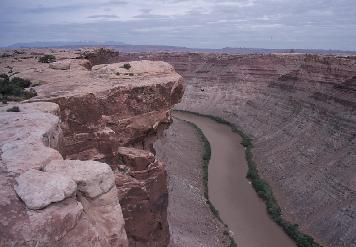
Just upstream from the photo above, the Green River joins the Colorado River and just downstream is the beginning of Cataract Canyon which is famous for its rafting trips. Just below the right end of the distant La Sal Mountains you can see me standing on the overhang. This photo is taken from the Overlook trail that begins at the “Doll’s House” camp areas.
This map shows the area around the confluence. Unfortunately it does not show the trails.
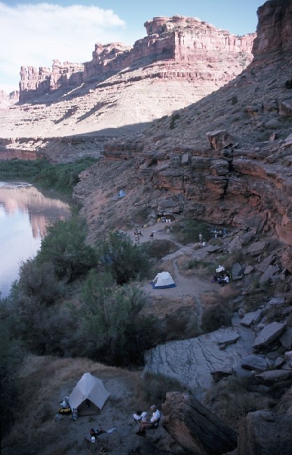
These last two photos were taken on the same day hike. We had camped at the month of Water Canyon on the Green River. We hiked up Water Canyon and then into Shot Canyon. We followed the trail up Shot Canyon to the rim near Chimney Rock. Most of the group returned to camp by walking and climbing down Water Canyon. Four of us walked along the four-wheel drive road to the Doll’s House and then northeast past Beehive Arch to the confluence overlook. From there we walked northwest and intersected Water Canyon which we walked down back to camp. The photo to the right is of this camp. Water Canyon can be seen just behind the camp. This spot was unusual in its proximity to the Green River. Most nights we camped up side canyons.